A practical analysis for visitors, foreign residents, and local users
Purpose: Explain what a visitor or local resident actually needs to know to move around South Korea: rail, metro, bus, taxi, ride-hailing, airport transfer, driving, ferries, cycling, accessibility, payment, etiquette, and recurring pain points.
Executive summary
South Korea has one of the most usable transportation systems in Asia for dense-city travel, but it is not one single system. It is a set of overlapping networks: national rail operated mainly by KORAIL, separate high-speed SRT service from Suseo, express and intercity buses, city subway systems, city buses, airport rail and buses, taxis, ferries, rental cars, and local micromobility. The result is excellent coverage in major cities and between major cities, but uneven service in rural areas and islands.
The core practical rule for travelers is simple: buy or prepare a Korean transportation card, use Naver Map or KakaoMap, and treat Google Maps as secondary until its Korea functionality is proven on the ground. Korea Tourism Organization lists Tmoney, EZL, WOWPASS, and Climate Card among the major transportation card options for travelers, with prepaid cards usable across public transportation and often retail payments. Seoul’s official tourism guide describes Tmoney as usable on public buses, subways, taxis, and many convenience stores.
For national trips, KTX is usually the fastest ground option on trunk corridors such as Seoul–Busan, Seoul–Daejeon, Seoul–Daegu, Seoul–Gwangju/Mokpo, and Seoul–Gangneung. KORAIL’s foreigner site sells KTX and other KORAIL train tickets and offers the KORAIL PASS for foreign visitors. The KORAIL PASS is useful for rail-heavy visitors, but KORAIL states that it does not include SRT, metropolitan railways, or temporary tourist trains. Express and intercity buses remain essential because they reach places rail does not and often stop nearer to smaller cities, resort areas, or university towns; Korea Tourism Organization distinguishes express buses, which use freeways for longer nonstop trips, from intercity buses.
For urban travel, subways and buses dominate. Seoul is the largest and most integrated system, Busan is the second most important metro city, Incheon is both a city network and Korea’s main international airport gateway, and Jeju Island is the exception: it has no subway or train network, so practical movement is by rental car, bus, taxi, private tour, or charter.
The biggest traveler friction points are payment compatibility, app dependence, last-train timing, luggage, rush-hour crowding, language barriers, parking, and the difference between tourist passes and resident commuter programs. Locals face a different set of recurring issues: long commutes across metropolitan regions, crowded peak trains, housing/parking constraints, fuel prices, school and work commute synchronization, transfer penalties when tapping incorrectly, and the need to choose between monthly passes such as Seoul’s Climate Card, Busan’s Dongbaek Pass, and nationwide K-Pass-type reimbursement schemes.
1. How the national system is organized
South Korea’s transportation system works best when understood as layers:
KORAIL operates KTX and conventional trains. SRT is a separate high-speed rail operator using Suseo Station in southeast Seoul as its main Seoul-area terminal. These services are best for intercity travel, not for within-city movement.
Buses fill gaps between rail corridors and often offer direct access to smaller cities, towns, beaches, ski areas, temples, and provincial terminals. They are also important when trains sell out during holidays.
Seoul–Incheon–Gyeonggi has the largest urban rail network. Busan has a strong metro system. Other cities outside this paper, such as Daegu, Daejeon, and Gwangju, have their own systems.
Buses are not secondary in Korea. They are often the best way to reach neighborhoods, hillside districts, beaches, parks, university areas, and destinations beyond a subway station.
Incheon International Airport, Gimpo Airport, Gimhae Airport, and Jeju Airport all depend on different mixes of rail, bus, taxi, and rental-car access. Incheon Airport’s transport network is especially important because most foreign visitors enter Korea through it.
Korea does not have unregulated private-car ride-hailing in the same way many countries do. Apps mainly dispatch licensed taxis. Kakao T is the dominant local service, while TABA and international taxi services are often easier for foreign visitors in Seoul and other tourist areas.
Private cars are common for families, commuters outside dense city centers, and Jeju travelers. They are often inconvenient in central Seoul and central Busan because of congestion, parking cost, and navigation complexity.
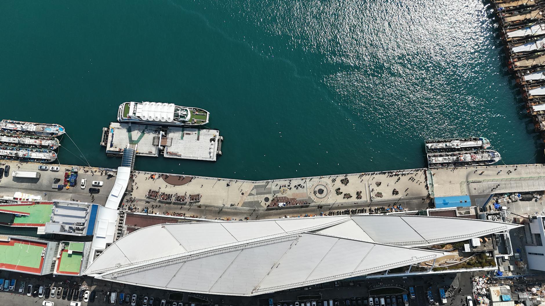
Ferries matter for Jeju, Incheon’s islands, and international sea links from Busan and Incheon. Korea Tourism Organization notes that international passenger ferry terminals are located in major port cities including Incheon, Pyeongtaek, Busan, and Donghae.
Seoul’s Ttareungi bike share is the most visible public bike system. Bike infrastructure exists in many cities, especially along rivers, but urban riding can be stressful where cycling lanes are discontinuous.
The system is dense, but not always unified from the user’s perspective. A single Tmoney card may work across a broad range of public transportation, but passes are often geographically limited; rail passes and transit cards are different products; and airport express trains, SRT, intercity buses, ferries, taxis, and city bikes each have their own rules.
- National high-speed and conventional rail
- Express and intercity buses
- Metropolitan subway and rail systems
- City buses and village buses
- Airport rail, limousine buses, and airport taxis
- Taxis and app-based taxi hailing
- Private vehicles and rental cars
- Ferries and island links
- Public bikes and micromobility
2. Payment: transportation cards, single tickets, passes, and refunds
2.1 The default solution: a rechargeable transportation card
Most visitors should begin with a transportation card. The familiar names are Tmoney, Cashbee, EZL, WOWPASS, and local or tourist variants. Korea Tourism Organization describes Korean transportation cards as chargeable prepaid cards that do not require an account and can provide transfer discount benefits on public transportation.
Practical benefits:
Practical concerns:
2.2 Tmoney versus Climate Card versus tourist passes
Tmoney / EZL / Cashbee are the safe general-purpose choices. They work in many cities and are best for visitors moving between Seoul, Busan, Jeju, and Incheon.
Climate Card is a Seoul-focused unlimited pass. Seoul’s official page describes it as a comprehensive transportation card for unlimited use of public transportation, Ttareungi, and Hangang Bus for a charged period. Its service range includes Seoul-based subway coverage, Seoul-licensed buses, Ttareungi, and Hangang Bus, but excludes the Shinbundang Line, subway lines outside the range, intercity/airport buses, and non-Seoul-licensed buses. This is excellent for a Seoul-heavy itinerary but not a replacement for a national transit card.
MPASS and short-term tourist products can make sense for visitors who will ride many times per day within the Seoul metropolitan area. Korea Tourism Organization describes MPASS as a time-limited transportation card for subway and city buses in Seoul and AREX all-stop service, excluding express trains, with usage limits and fixed day options. It is less flexible than a normal Tmoney card and should be compared against the Climate Card and your expected daily rides.
KORAIL PASS is for national rail, not city transportation. KORAIL says it is for foreigners visiting Korea and allows use of KORAIL passenger trains for a set period, but it does not include SRT, metropolitan railway, or temporary tourist trains. Buy it only if your itinerary includes enough KORAIL train rides to beat normal ticket pricing.
K-Pass and local commuter programs are mainly resident commuter tools, not short-stay tourist tools. Korea.net describes K-Pass as a program that reimburses a share of monthly public transportation fares and covers modes such as city and express buses, subways, GTX, and airport rail transit. Recent 2026 reporting indicates K-Pass coverage expanded nationwide, but eligibility, registration, and card issuance are resident-oriented and may require Korean banking or residence status. Locals should compare it to regional programs, while tourists should assume Tmoney/Climate Card/KORAIL PASS are more practical.
2.3 Payment problems visitors actually run into
Foreign visitors often run into three payment problems:
First, foreign credit cards are not always accepted at every transit interface. Some official sites and station counters handle foreign cards well, but some ticketing platforms, kiosks, or apps are still resident-oriented.
Second, apps may require Korean phone-number or identity workflows. This is improving, especially for tourist-focused products, but a physical card and cash backup remain smart.
Third, transportation passes are not universal. A Seoul pass may not cover Incheon Airport Express, Gyeonggi buses, SRT, or Busan. A KORAIL pass may cover KTX but not metro. A Busan tourist pass may include attractions and local transport features but not national rail.
The safest setup for a first-time visitor is:
- No need to buy a single ticket every time.
- Works on subways and most local buses.
- Often works in taxis and convenience stores.
- Makes bus-to-subway and subway-to-bus transfer discounts possible.
- Reduces cash-handling and language friction.
- Keep enough balance before boarding buses. You cannot always top up on board.
- Some machines and stores may be easier with cash than with foreign cards. Foreign-issued card acceptance is improving, but visitors should still carry Korean won for top-ups.
- Use one card per person for normal transfers. Sharing one card across multiple people can complicate or invalidate transfer discounts.
- Tap when boarding buses and tap when getting off if the system expects it. This matters for distance pricing and transfer logic.
- For single-use subway tickets, expect a deposit/refund process rather than simply throwing the card away. Incheon’s official guide notes that single journey subway fare cards have a 500-won deposit refundable at station machines.
- A physical Tmoney/EZL/Cashbee-style card with cash balance.
- A normal international credit card for hotels, restaurants, and ticket counters.
- Naver Map or KakaoMap.
- A backup taxi app such as Kakao T, TABA, or Uber Taxi depending on phone/card compatibility.
- Rail tickets booked through KORAIL official channels for KTX-heavy trips.
4. National rail: KTX, KORAIL, SRT, and conventional trains
4.1 When rail is best
Use rail when moving between major cities on trunk corridors:
KTX is usually faster and more predictable than driving. It is especially useful on Friday evenings, Sunday returns, long weekends, and holiday periods.
4.2 KORAIL tickets
KORAIL’s foreigner site allows visitors to book KTX and other train tickets online. For travel days near Seollal or Chuseok, buy as early as possible. Seats can sell out quickly because millions of locals travel to family homes.
Practical rail tips:
4.3 KORAIL PASS
KORAIL PASS can save money for foreign visitors doing several long KTX rides. It is not automatically worth it. Calculate normal tickets first.
Use it when:
Do not use it when:
KORAIL explicitly says the pass does not include SRT, metropolitan railway, or temporary tourist trains.
4.4 SRT
SRT is useful for travelers based in southeast Seoul, Gangnam, Jamsil, or Bundang because it departs from Suseo Station, not Seoul Station. It runs on high-speed corridors to cities such as Busan and Mokpo. But SRT is separate from KORAIL. It is not covered by KORAIL PASS, and foreign visitors may find booking less straightforward than KORAIL.
Use SRT if:
Use KTX if:
4.5 Conventional trains
Slower KORAIL services such as ITX, Saemaeul, Mugunghwa, and Nuriro can be useful for secondary cities and lower-cost travel. They are not glamorous, but they often solve real itinerary problems when KTX does not stop close to the place you need.
- Seoul ↔ Busan
- Seoul ↔ Daejeon
- Seoul ↔ Daegu
- Seoul ↔ Gwangju/Mokpo
- Seoul ↔ Gangneung
- Seoul ↔ Jeonju/Iksan
- Busan ↔ Daegu/Daejeon/Seoul
- Station names matter: Seoul Station, Yongsan, Cheongnyangni, Suseo, Busan Station, Dongdaegu, Daejeon, Gwangju-Songjeong, Mokpo, Gangneung, etc. The nearest “city” station may not be the station your train uses.
- KTX tickets are for assigned trains and seats unless you buy a standing/non-reserved option.
- Arrive early enough to find the platform and car number, especially with luggage.
- Keep your passport if using tourist passes or discounted tourist products.
- Do not assume metro-style tap-in gates. Many intercity trains rely on ticket inspection or onboard checks rather than subway gates.
- Large luggage space is limited. Board promptly if you need luggage rack space.
- You are doing multiple KTX rides within a short period.
- You are comfortable reserving seats ahead.
- Your cities are on KORAIL routes.
- You are not relying on SRT, metro, or local buses as the main cost.
- You are staying mostly in Seoul.
- You are only doing Seoul ↔ Busan once.
- You need SRT from Suseo.
- You are traveling mostly by bus or plane.
- Your itinerary is flexible but seats may be sold out.
- Your accommodation is much closer to Suseo than Seoul Station.
- The SRT schedule is better.
- You can buy tickets successfully or purchase in person.
- You want official foreigner booking.
- You are using KORAIL PASS.
- You are staying near Seoul Station, Hongdae, Myeongdong, Jongno, or Yongsan.
5. Express buses, intercity buses, airport buses, and local buses
5.1 Express versus intercity buses
Korea Tourism Organization explains that express buses use freeways for longer trips without stops, while intercity buses serve broader regional travel patterns. For visitors, the difference matters less than the departure terminal and arrival terminal.
Common bus categories:
5.2 Why buses matter even with KTX
Buses are often best for:
5.3 How to use city buses
Basic routine:
Concerns:
- Express bus: long-distance, often terminal-to-terminal, fewer stops.
- Intercity bus: regional routes, often with intermediate stops.
- Airport limousine bus: airport-to-city or airport-to-hotel-area routes.
- City bus: ordinary municipal routes.
- Village/local bus: neighborhood routes, common around subway stations and residential areas.
- Night bus: late-night service in some cities, especially Seoul.
- Smaller towns without direct KTX.
- Beach and mountain destinations.
- Routes where the train station is far outside town.
- Late or early travel when trains are limited.
- Direct airport access to hotels.
- University towns and suburban commuter districts.
- Jeju Island, where there is no rail system.
- Check the route in Naver Map/KakaoMap.
- Confirm route number, direction, and stop location.
- Board at the front unless local rules indicate otherwise.
- Tap your transportation card.
- Press the stop button before your stop.
- Tap off when exiting if the bus uses distance/transfer logic.
- Transfer within the allowed window using the same card.
- Bus stops in each direction may be on different streets.
- Some stops serve many routes; stand where your bus will actually stop.
- Last buses can be earlier than expected.
- Rush hour buses can be full and may pass stops if overloaded.
- Airport buses are comfortable with luggage; normal city buses are not ideal with large suitcases.
- Local buses are less forgiving if you cannot read Korean or identify your stop.
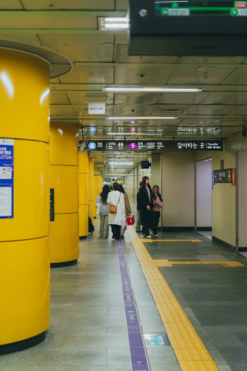
6. Subways and metropolitan rail
Korean subways are clean, frequent, and efficient. Seoul and Busan are the main systems in this paper; Incheon is integrated with the Seoul metropolitan network; Jeju has no subway.
General subway usage:
Seoul’s official tourism site states that the subway system operates from approximately 5:30 AM until midnight, with each line represented by a distinctive color. This is a useful baseline, not a guarantee for your specific last train.
- Use line color, line number, destination, and station number.
- Pay attention to express versus local services on some lines.
- Follow transfer signs carefully; some transfers are long.
- Some stations have many exits; choose the right exit before leaving the paid area.
- Last-train times vary by line and direction.
- Elevators may be far from the shortest walking path.
- Rush hour is intense: roughly weekday mornings and evenings.
- Priority seats are taken seriously. Avoid sitting there unless you qualify.
- Queue markings on platforms matter.
7. Taxis and ride-hailing
7.1 Taxi categories
Korea has standard taxis, deluxe taxis, jumbo/van taxis, international taxis, and accessible taxi services. Taxis are generally safe and metered, but language and app/payment setup can be difficult for visitors.
Seoul’s official tourism guide describes International Taxi as an officially designated taxi service for foreigners, with foreign-language-capable drivers and generally higher fares than regular taxis. Korea Tourism Organization also describes ride-hailing apps such as Kakao T and TABA for travelers.
7.2 Apps
Kakao T is widely used by Koreans and tourists, with service coverage across Korea including Jeju Island according to Korea Tourism Organization. It is the default local app, but account setup and payment options may vary by traveler.
TABA was developed for international tourists with support from Seoul Metropolitan Government and can be easier for visitors because it was built around foreign tourist use cases. Korea Tourism Organization says TABA allows sign-up by mobile number or Google/Apple ID, gives estimated fares, and supports tourist-oriented destination search.
Uber Taxi exists in Korea but dispatches licensed taxis rather than private vehicles in the way Uber operates in some other countries. It can be useful if it accepts your account and payment method.
7.3 Taxi concerns
- Have the destination in Korean.
- Screenshot the address and phone number.
- Check that the meter is used unless you booked a fixed airport/tour service.
- Late-night surcharges exist.
- Intercity taxi rides can become expensive quickly.
- Some taxi drivers may reject very short or difficult trips during peak periods.
- Large luggage may require a jumbo taxi or van.
- In rural areas and parts of Jeju, return taxis can be hard to find unless you prearrange.
8. Airports and domestic flights
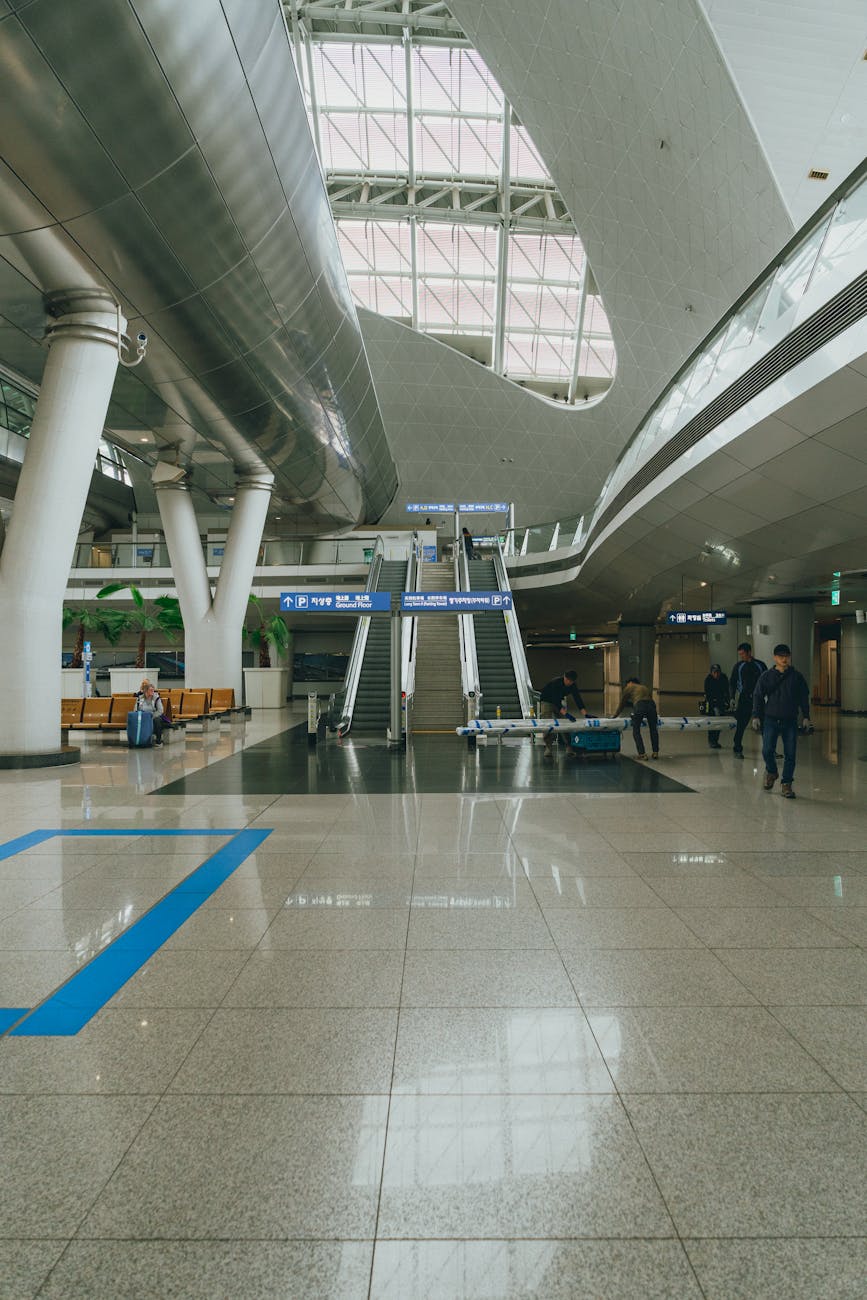
8.1 Incheon International Airport
Incheon International Airport is Korea’s main international gateway. Korea Tourism Organization describes access from Incheon Airport to downtown Seoul by AREX, Seoul Subway, airport limousine bus, and taxis, and states that Incheon Airport Terminal 1 to Seoul Station is about 60 km, taking 43 minutes by AREX and around 1 hour 30 minutes by car depending on traffic.
Main options:
Incheon Airport’s own public transportation pages organize bus, train, taxi/call van, and related services for travelers.
8.2 Gimpo Airport
Gimpo is the practical airport for many domestic flights, especially Jeju. It is connected to Seoul by subway/rail and is easier than Incheon for central Seoul domestic travel.
8.3 Jeju flights
Flying is the normal way most travelers reach Jeju. Korea Tourism Organization’s Jeju access guide covers both air and ferry access, and Jeju International Airport publishes domestic and international flight schedule information.
8.4 Airport buses
Airport buses are often the most comfortable option when you have luggage and your hotel is near a stop. Seoul’s official airport page describes airport limousine buses from Gimpo and Incheon to Seoul destinations such as hotels and tourist areas, with travel time varying by route and traffic. The tradeoff is traffic risk.
- AREX Express Train: fastest predictable rail to Seoul Station; reserved-style airport rail product.
- AREX All-Stop Train: cheaper, stops at intermediate stations, useful for Hongdae/Gimpo/airport corridor.
- Airport limousine buses: best for direct access to hotel districts with luggage.
- Taxi/call van: best for groups, late arrivals, mobility needs, or destinations poorly served by transit.
- Domestic transfer: Gimpo Airport is often more important than Incheon for domestic flights, especially Seoul–Jeju.
9. Private vehicles, rental cars, road rules, and parking
9.1 When driving makes sense
Driving makes sense for:
Driving usually does not make sense for:
9.2 Legal and rental requirements
Korea Tourism Organization says short-term travelers may rent a car with an international driver’s license/permit, must be over 21, have been in Korea for less than one year, and must present passport or alien registration card; some companies also require the home-country license, and rental fees may require a credit card under the driver’s name. Korean legal guidance states that a person entering Korea with a valid international driving permit or mutually recognized foreign license may drive for one year from the date of entry, subject to restrictions.
Practical rental checklist:
9.3 Road and parking concerns
For visitors, the blunt advice is: drive in Jeju if you are qualified and comfortable; avoid driving in central Seoul unless you have a specific reason.
- Jeju Island road trips.
- Rural temples, parks, coastlines, and mountain destinations.
- Families with children or elderly relatives.
- Travelers with heavy luggage.
- Business travelers visiting industrial zones.
- Locals living outside dense transit corridors.
- Central Seoul sightseeing.
- Central Busan sightseeing.
- Short trips between major KTX-connected cities.
- Myeongdong, Hongdae, Gangnam, Jongno, Haeundae, Seomyeon, and other congested districts.
- Visitors uncomfortable with dense urban driving and Korean-language navigation.
- Passport.
- Original home-country driver’s license.
- International Driving Permit, not a photo or PDF.
- Credit card in the driver’s name.
- Korean phone number or reachable contact method if required.
- Insurance understanding.
- Navigation app or car navigation set to English if available.
- Korea drives on the right side of the road.
- Speed cameras and red-light cameras are common.
- Toll roads are common for intercity driving.
- Parking can be expensive and hard to find in city centers.
- Apartment and hotel parking rules vary.
- Many roads have bus-only lanes with time restrictions.
- Navigation may route you through dense alleys if you blindly trust it.
- In winter, mountain roads can be icy; in summer, heavy rain can disrupt driving.
10. Ferries and ships
Ferries matter in three contexts.
First, Jeju access. Korea Tourism Organization lists ferry routes from mainland ports such as Wando and Jindo to Jeju and notes that personal ID is required when boarding. Ferries are slower than flights but can be useful for travelers with vehicles, pets, or scenic/slow-travel preferences.
Second, Incheon islands. Incheon’s official public transport page describes ship travel to islands in Ongjin County and around Wolmido, with sailing schedules and fares requiring route-specific checks.
Third, international ferries. Korea Tourism Organization notes international passenger ferry terminals in port cities including Incheon and Busan. Busan Port International Passenger Terminal primarily handles passenger routes to Japanese destinations such as Fukuoka, Osaka, Shimonoseki, and Hitakatsu.
Concerns:
- Weather can cancel ferries.
- Arrive early for check-in.
- Bring ID/passport.
- Schedules can change seasonally.
- Booking websites may be Korean-only.
- Vehicle ferry rules require extra planning.
11. Bicycles, Seoul Bike, and micromobility
Bicycles are best along rivers, parks, and planned bike routes. Korea Tourism Organization notes bike rental services in various cities and highlights Seoul’s Ttareungi as the most notable public bike service. Seoul describes Ttareungi as an unmanned rental system usable anywhere, anytime by anyone.
Use bikes for:
Concerns:
- Han River paths in Seoul.
- Riverside parks in Busan.
- Short last-mile travel in good weather.
- Leisure rides rather than high-pressure commutes.
- Not all roads are bike-friendly.
- Pedestrians may share paths.
- Helmets and safety rules matter.
- Weather and air quality can make cycling unpleasant.
- Public bikes require app/payment setup; foreign users should test before relying on them.
- E-scooters and personal mobility devices have local rules and enforcement changes; verify current rules before riding.
12. Accessibility and mobility needs
Accessibility has improved substantially in Seoul and major systems, but the user experience varies by station, line, neighborhood, and time of day.
Seoul publishes subway accessibility facility information, including elevators, escalators, wheelchair lifts, ramps, accessible restrooms, voice guidance, sign-language video phones, and related station-by-station features. Seoul’s accessible tourism guide says accessible taxis are yellow vans equipped with ramps or lifts and can accommodate one wheelchair and five passengers. Seoul also describes policy goals such as one accessible route at all subway stations, low-floor buses, and expanded call taxis for persons with disabilities.
Practical concerns:
Travelers with mobility needs should plan routes by elevator availability, not only by fastest time. Build slack into every transfer.
- Transfer routes can be long even when accessible.
- Elevators may be at specific exits far from your destination.
- Some older stations may require detours.
- Rush hour is hard for wheelchair users, stroller users, and travelers with large luggage.
- Low-floor buses exist, but not every bus or stop experience is easy.
- Accessible taxis usually require advance planning and may have eligibility or booking procedures.
13. Safety, etiquette, and traveler concerns
13.1 Safety
Public transportation in Korea is generally safe. The main risks are not violent crime; they are getting lost, missing last trains, boarding the wrong bus direction, losing a card/phone, weather disruption, or underestimating distances inside stations.
Safety habits:
13.2 Etiquette
Important norms:
13.3 Luggage
13.4 Holidays and crowding
During Seollal, Chuseok, and major long weekends, book trains, express buses, domestic flights, and rental cars early. Locals travel at scale, and normal assumptions about seat availability fail.
- Keep your phone charged.
- Screenshot hotel address and route.
- Know last-train time before nightlife.
- Avoid carrying giant luggage during rush hour.
- Keep valuables close in crowds.
- Use official taxi apps or marked taxis.
- Use 1330 for travel help and 112/119 for emergencies as appropriate.
- Queue at platform markings.
- Let people exit before boarding.
- Keep voices low on trains and buses.
- Do not block doors.
- Move inside buses and trains.
- Priority seats are for elderly passengers, pregnant passengers, disabled passengers, and people with small children.
- On escalators, follow local flow; do not stand blocking hurried commuters.
- Backpacks should be lowered in crowded trains.
- Avoid eating messy food on trains and buses.
- Airport buses are better than subways for large suitcases if your hotel is near a stop.
- KTX has limited large-luggage space.
- Seoul subway transfers can involve stairs, long walks, and crowded platforms.
- Taxis are best for families with multiple suitcases.
- Store luggage at stations or hotels if sightseeing between cities.
14. Decision guide: which mode should you use?
| Situation | Best first choice | Backup |
|---|---|---|
| Incheon Airport to Seoul Station | AREX Express | Airport bus or taxi |
| Incheon Airport to hotel near Myeongdong/Gangnam/Jamsil | Airport limousine bus | Taxi/call van |
| Seoul sightseeing | Subway + bus | Taxi late night |
| Seoul nightlife after subway closes | Owl/night bus or taxi | Stay near nightlife district |
| Seoul to Busan | KTX | SRT or express bus |
| Seoul to Jeju | Domestic flight from Gimpo | Ferry only if slow-travel/vehicle plan |
| Jeju sightseeing | Rental car | Tourist shuttle + taxis |
| Busan sightseeing | Metro + bus | Taxi for hills/coast |
| Incheon day trip from Seoul | Subway/AREX/local rail | Bus or taxi |
| Family with luggage | Airport bus or taxi | Subway only off-peak |
| Wheelchair/stroller route | Subway with elevator planning | Accessible taxi |
| Rural temple/coast/mountain | Car or intercity bus | Taxi/charter |
| Resident daily commute in Seoul | Climate Card/K-Pass comparison | Tmoney pay-per-ride |
| Resident daily commute in Busan | Dongbaek Pass/K-Pass comparison | Tmoney/Cashbee |
1. System identity
Seoul is the center of Korea’s transportation system. It has the country’s largest subway network, dense bus coverage, national rail terminals, two airport access corridors, taxi coverage, public bikes, river transport, and intense commuter flows from Gyeonggi-do and Incheon.
For visitors, Seoul can feel overwhelming at first, but it becomes easy once you rely on subway line numbers, station exits, and Naver/Kakao routing. For locals, the system is essential infrastructure: many people live car-light or car-free inside Seoul, while suburban commuters often combine buses, metro, GTX/rail, and long transfers.
2. Subway and metropolitan rail
Seoul’s subway is usually the best way to move across the city. The official Seoul tourism site says the subway operates approximately from 5:30 AM to midnight, with distinctive colors for each line.
Important practical points:
Key stations and roles:
- Station exits matter enormously. Exit 2 and Exit 10 can place you on completely different sides of a major road.
- Transfers can be long. Some “transfer stations” involve several minutes of walking.
- Express/local distinctions matter on some lines.
- Last trains are direction-specific. The station may still be open, but your final train may have already left.
- Rush hour is crowded enough that visitors with luggage should avoid it.
- Many tourist routes involve Line 1, Line 2, Line 3, Line 4, Line 5, Line 6, Line 7, Line 9, AREX, Gyeongui-Jungang, and Suin-Bundang, not just “Seoul Metro” lines.
- Seoul Station: KTX, AREX, subway, airport access.
- Yongsan: KTX/Honam rail, central rail access.
- Cheongnyangni: eastern rail access, Gangwon routes.
- Suseo: SRT high-speed rail.
- Hongik Univ.: AREX all-stop, Line 2, nightlife/accommodation.
- Gangnam: business/nightlife, heavy bus/subway use.
- Express Bus Terminal: subway hub and long-distance bus terminal.
- Jamsil: southeast Seoul, Lotte World, Hangang Bus connections.
- Gimpo Airport: domestic flights and rail connections.
3. Buses
Seoul buses are color-coded. Seoul’s official bus guide describes blue buses as mainline routes connecting districts, green buses as branch routes connecting residential areas to subway stations and blue bus routes, yellow buses as circulation routes, and red buses as wide-area routes connecting Seoul with the metropolitan area. Seoul’s public transportation page similarly explains trunk, branch, circulation, and rapid bus roles.
Visitor guidance:
Local concerns:
- Use buses for hillside neighborhoods, palace-to-market trips, Han River parks, and destinations not close to a subway.
- Use the subway for long cross-city travel unless a bus is clearly direct.
- Tap on and tap off.
- Watch for the bus direction. Stops across the street may not serve the same route pattern.
- Bus-only median lanes are efficient but confusing for visitors because stops may be in the road center.
- Peak buses can be packed.
- Red buses are vital for Gyeonggi commuters but not always useful for tourists.
- Village buses solve “last hill” trips to residential areas.
4. Climate Card
Seoul’s Climate Card is one of the most important local fare products. Seoul describes it as an unlimited-use transportation card for public transportation, Ttareungi, and Hangang Bus after charging for a set period. Its service range includes Seoul-based subway coverage, partial Gyeonggi-serviced subway routes, Seoul-licensed buses, Ttareungi, and Hangang Bus, while excluding items such as the Shinbundang Line, subway lines outside the service range, intercity/airport buses, and non-Seoul-licensed buses.
Who should consider it:
Who should not rely on it alone:
- Visitors staying mostly in Seoul and taking several rides per day.
- Residents commuting within Seoul.
- Travelers who want predictable daily transportation cost.
- Bike users who will use Ttareungi if included in their pass type.
- Visitors going to Incheon Airport, Suwon, DMZ tours, Busan, Jeju, or other cities.
- People riding non-Seoul buses.
- People using SRT/KTX.
- People using Shinbundang Line frequently.
5. Ttareungi public bike
Seoul’s Ttareungi public bike system is useful for Han River paths, parks, and short trips in flat areas. Seoul describes it as an unmanned rental system usable anywhere, anytime by anyone. It is not a replacement for subway travel, but it can be excellent along the Han River and in districts with dense docking stations.
Concerns:
- App setup before first use.
- Bike availability at docks.
- Weather and air quality.
- Riding near pedestrians.
- Limited usefulness in steep neighborhoods.
6. Hangang Bus
The Hangang Bus is Seoul’s river transport service. Seoul’s policy page says official service began September 18, 2025, and later updates in 2026 described full-route service resuming with eastern and western lines centered on Yeouido. For most visitors, this is more scenic supplementary transport than a core commute tool. For some residents, it may be useful if origin and destination line up with piers and shuttle links.
Use it for:
Do not use it when:
- Scenic cross-river experience.
- Itineraries near Yeouido, Jamsil, Magok, or connected piers.
- A slower, pleasant alternative when time is flexible.
- You are rushing to a timed ticket.
- Weather is poor.
- Your destination is far from a pier.
- A direct subway route is much faster.
7. Taxis and late night
Seoul taxis are useful after subway service ends, during rain, with luggage, and for trips involving hills. Kakao T is the local default; TABA is designed for international tourists with Seoul government support. Seoul also has International Taxi services for foreign visitors.
Night concerns:
- After midnight, taxi demand can spike in Hongdae, Itaewon, Gangnam, Jongno, and university/nightlife areas.
- Seoul’s Owl Bus network exists for late-night service; Seoul describes Owl Buses as buses operating between midnight and 5 AM on routes serving high commuter-demand areas.
- Late-night taxi surcharges apply.
- App dispatch may be easier than street hailing.
8. Airports: Incheon and Gimpo
Seoul visitors should distinguish:
From Incheon, choose:
Korea Tourism Organization notes AREX and airport buses among the main options from Incheon Airport to downtown Seoul, with AREX to Seoul Station taking 43 minutes from Terminal 1.
- Incheon International Airport: main international gateway; farther from central Seoul.
- Gimpo Airport: closer domestic/international regional airport; often used for Jeju.
- AREX Express for Seoul Station.
- AREX all-stop for Hongdae/Gimpo/corridor stops.
- Airport limousine bus for direct hotel-district access.
- Taxi/call van for groups, late arrivals, or special needs.
9. Driving and parking
Driving in central Seoul is usually a mistake for visitors. Locals drive when they need to, but the costs are real: parking scarcity, congestion, bus lanes, camera enforcement, apartment parking rules, and complex interchanges.
Drive only if:
Otherwise use transit and taxis.
- You have a business reason.
- You are leaving Seoul for rural destinations.
- You have mobility or family needs.
- Your hotel confirms parking.
- You are comfortable with Korean roads.
10. Seoul-specific concerns
- Station exits: always route to the exact exit.
- Transfer length: subway transfers can be physically demanding.
- Crowding: avoid weekday peak with luggage.
- Hills: neighborhoods like Itaewon, Namsan, parts of Seongbuk, and university areas can be steep.
- Last train: check before dinner/nightlife.
- Climate Card boundaries: do not assume Seoul pass covers Gyeonggi/Incheon travel.
- Accessibility: plan by elevator, not by shortest route.
1. System identity
Busan is Korea’s second major transport city and the country’s main southern port. It has a usable metro, strong bus network, intercity rail through Busan Station, airport access via Gimhae International Airport and Busan-Gimhae Light Rail, ferries, hills, beaches, and long coast-hugging travel times.
Busan feels easier than Seoul in scale, but it is physically stretched. Haeundae, Gwangalli, Seomyeon, Nampo, Busan Station, Songdo, Taejongdae, and Gimhae Airport are not all close to each other. The metro is extremely useful, but many final destinations require buses or taxis.
2. Metro and urban rail
Visit Busan says the Busan Metro consists of Lines 1–4, the Busan-Gimhae Light Rail Transit, and the Donghae Line, connecting Busan with major areas across Busan, Gimhae, and Yangsan.
Important roles:
Practical visitor patterns:
- Line 1: north-south spine, Nopo, Seomyeon, Busan Station, Nampo, Jagalchi.
- Line 2: east-west, Seomyeon, Centum City, Haeundae, Gwangan-area access.
- Line 3: northwest connections and transfers.
- Line 4: northeastern local coverage.
- Busan-Gimhae Light Rail: airport and Gimhae connection.
- Donghae Line: useful for eastern coastal rail access, including areas toward Songjeong and beyond.
- Stay near Seomyeon for central transit.
- Stay near Haeundae for beach/resort atmosphere but expect longer trips to Nampo/Busan Station.
- Stay near Busan Station for rail convenience, ferries, and quick arrival/departure.
- Use metro for long cross-city travel and buses/taxis for final hillside/coastal destinations.
3. Buses
Busan buses are essential because many attractions sit away from subway stations or on hills/coastal roads.
Use buses for:
Concerns:
- Gamcheon Culture Village.
- Taejongdae.
- Songdo.
- hillside residential districts.
- some beach/coastal transfers.
- routes where metro would require backtracking.
- Busan hills make walking from subway stations harder than the map suggests.
- Traffic near beaches can be heavy on weekends and summer evenings.
- Buses can be crowded during commute hours and festival periods.
- Visitors should use route apps because stop names and directions can be confusing.
4. Airport access: Gimhae International Airport
Gimhae Airport is connected by the Busan-Gimhae Light Rail. This is usually the most reliable transit option if your destination is near the metro network. Taxis are reasonable for groups or luggage, but traffic can vary.
5. KTX and intercity travel
Busan Station is a major KTX terminal. For Seoul–Busan, KTX is usually the best ground option. Busan also has bus terminals that may be better for regional trips.
Practical distinction:
Busan Port Authority describes Busan Port International Passenger Terminal as a major terminal with immigration, amenities, and passenger/ferry berths. Korea Tourism Organization notes routes from Busan Port International Passenger Terminal to Japanese destinations such as Hitakatsu, Fukuoka, Osaka, and Shimonoseki.
- Use KTX for Seoul, Daejeon, Daegu, and major rail cities.
- Use buses for towns not conveniently served by rail.
- Use ferry terminal for international sea travel to Japan when applicable.
6. Dongbaek Pass and local resident concerns
Busan has local commuter fare programs that matter more to residents than short-stay visitors. Busan announced in 2026 that Dongbaek Pass had surpassed 850,000 subscribers and that unlimited public transportation in Busan would be available for KRW 45,000 per month starting April 1, 2026, through expanded Dongbaek Pass/K-Pass-linked benefits.
For locals and foreign residents:
For tourists:
- Compare Dongbaek Pass, K-Pass, and normal Tmoney/Cashbee use.
- Check eligibility requirements, banking requirements, and whether you need a residence card.
- If you commute daily by subway/bus, a pass can matter.
- If you ride only occasionally, pay-per-ride may remain simpler.
- Do not spend time on resident commuter products unless you are staying long-term.
- Use Tmoney/EZL/Cashbee or a Visit Busan Pass product if it fits your attractions.
7. Visit Busan Pass and tourist movement
The Visit Busan Pass is an attraction-oriented tourist pass with transportation and shopping benefits. It is not the same as a resident commuter pass. It can be useful if your sightseeing plan includes several covered attractions and you want bundled convenience.
8. Taxis and driving
Taxis are useful in Busan because of hills and coastal geography. A taxi can save a lot of effort for Gamcheon, Taejongdae, Songdo, night trips, and routes where bus transfers are annoying. Driving is less painful than central Seoul but still not ideal around beach districts, narrow hillside roads, and weekend hotspots.
Parking near Haeundae, Gwangalli, Nampo, and major festivals can be difficult. Visitors should not rent a car just for central Busan sightseeing.
9. Busan-specific concerns
- Distance distortion: Busan looks compact on maps but is stretched by mountains and coastline.
- Beach traffic: Haeundae/Gwangalli weekends can slow buses and taxis.
- Hills: walking routes can be steep.
- Rail station location: Busan Station is convenient for KTX, not necessarily for beach stays.
- Airport: Gimhae is connected by light rail, but late-night arrivals may need taxi.
- Weather: typhoons/heavy rain can disrupt coastal plans and ferries.
- Accessibility: metro stations vary; check elevator routes.
1. System identity
Jeju is the major exception in this paper. It is part of South Korea, but its transportation logic is island logic, not metropolitan logic. There is no subway or train system. Visitors move by rental car, bus, taxi, airport limousine, tourist shuttle, private charter, tour bus, bicycle on selected routes, or ferry/flight access.
The biggest planning decision is whether to rent a car. Without a car, Jeju is still possible, but your itinerary must be slower and organized by region.
2. Getting to Jeju
Most visitors fly to Jeju International Airport. Jeju Airport publishes flight schedule information, and domestic routes connect Jeju with major Korean airports. Korea Tourism Organization also covers ferry access from mainland ports such as Wando and Jindo and notes ID requirements for ship boarding.
Flight is best for:
Ferry is best for:
- Most visitors.
- Short trips.
- Seoul/Busan connections.
- Travelers without vehicles.
- Bringing a vehicle.
- Slow travel.
- Travelers starting from southern/western mainland ports.
- Travelers with special luggage or pet plans, subject to operator rules.

3. Rental cars
Jeju is Korea’s strongest case for renting a car. Visit Jeju explains that major rental companies operate frequent shuttle buses from the airport to their premises, and arriving travelers should follow “Rental Car Shuttles” signs.
Renting a car is best if:
Concerns:
- You are visiting east, west, south, and inland attractions.
- You want sunrise/sunset flexibility.
- You are traveling with family.
- You are staying outside Jeju City or Seogwipo core areas.
- You want to visit waterfalls, oreums, beaches, museums, cafes, and coastal roads efficiently.
- You need proper documents: passport, home license, IDP, credit card, and rental eligibility.
- Book early during peak seasons.
- Parking at top attractions can fill.
- Rural roads can be dark at night.
- Weather can change fast.
- Do not drink and drive.
- Speed cameras are common.
4. Public buses
Visit Jeju’s traffic information page lists buses, tourist shuttle buses, airport limousine buses, charter buses, and city tour buses as Jeju transport options. City buses are the low-cost backbone for car-free travel, but they require patience.
Bus travel works best if:
Bus travel is frustrating if:
- You group attractions by region.
- You stay near Jeju City, Seogwipo, or a strong bus corridor.
- You accept fewer stops per day.
- You use real-time route apps.
- You carry light luggage.
- You plan to hop across the island repeatedly.
- You visit remote cafes/beaches.
- You travel late at night.
- You have children, elderly relatives, or mobility needs.
- Bad weather makes waiting unpleasant.
5. Tourist shuttle buses 810 and 820
Visit Jeju describes tourist shuttle buses 810 and 820. Bus 810 circles the east side of the island; bus 820 circles the west side; day-pass options and transit-center boarding are available.
Use them for:
Limitations:
- Car-free sightseeing.
- Oreum and inland attractions.
- West-side museum/attraction clusters.
- Structured day trips.
- They do not cover everything.
- You still need to reach the transit center.
- Frequency and timing shape your day.
- A taxi may still be needed for gaps.
6. Airport limousine and city tour bus
Jeju Airport’s public transportation page lists limousine bus route 600 from Gate 5, with fares varying by distance. Visit Jeju also describes Airport Limousine Bus #600 as serving Jeju Airport, Jungmun Resort, and Seogwipo KAL Hotel, with stops including hotels and major southern destinations.
The Jeju City Tour Bus describes a circular route visiting 21 locations in Jeju City and transportation hubs including Jeju International Airport, cruise terminal, coastal ferry terminal, and Jeju Bus Terminal.
Use these when:
- Staying in Jeju City or Jungmun/Seogwipo corridors.
- You want simple airport-to-resort movement.
- You do not want to rent a car immediately.
- You are doing light city sightseeing.
7. Taxis, taxi tours, and charters
Taxis are practical in Jeju, but coverage can thin out away from towns and tourist clusters. Visit Jeju has a page for taxis and taxi tours, with the caveat that driving time and rates vary by traffic.
Use taxis for:
Concerns:
- Short hops from a bus stop to an attraction.
- Bad weather.
- Evening restaurant returns.
- Groups splitting cost.
- A one-day taxi tour instead of renting.
- Return taxi availability.
- Language.
- Cost over long distances.
- App dispatch in remote areas.
- Need to prearrange for sunrise hikes or late-night returns.
8. Biking and walking
Jeju is beautiful for cycling but not automatically easy. Wind, hills, weather, and road exposure matter. Casual visitors should treat cycling as an activity, not a universal transport solution. Walking is best in Jeju City, Seogwipo, Olle Trail segments, beaches, and market areas, not for cross-island movement.
9. Jeju-specific concerns
- No rail: do not plan as if you can “metro” around.
- Regional planning: group east/west/south/north days.
- Weather: wind and rain can disrupt buses, ferries, flights, and driving.
- Car rental documents: IDP must be valid and physical.
- Peak seasons: book cars and flights early.
- Taxi gaps: remote returns need planning.
- Last buses: evening service can limit dinner and nightlife.
- Local residents: car dependence, tourist traffic, parking pressure, and seasonal crowding are daily issues.
1. System identity
Incheon is both a major city and Korea’s primary international gateway. Many visitors experience Incheon only as “the airport,” but the city also includes Songdo, Chinatown, Wolmido, old port areas, islands, residential districts, industrial zones, and subway connections into Seoul.
Incheon’s transport identity is hybrid:
- Airport rail and buses for national/international arrivals.
- Incheon Subway lines and Seoul Metropolitan Subway connections.
- City buses.
- Ferries to islands.
- Taxis and airport call vans.
- Tourist monorail/sea train around Wolmido.
2. Airport transport
Incheon Airport’s official public transportation page groups bus, train, taxi/call van, and maglev information for travelers. Korea Tourism Organization describes Incheon Airport access to Seoul by AREX, Seoul Subway, airport limousine bus, and taxi.
Main airport-to-city choices:
Incheon Airport’s taxi guide notes that Incheon International Airport is a joint operation area for taxis from Seoul, Incheon, and parts of Gyeonggi, with boundary surcharge rules depending on destination. This matters because airport taxi pricing can be more complex than an ordinary city taxi.
- AREX Express: airport to Seoul Station fast and predictable.
- AREX All-Stop: cheaper, stops at intermediate areas such as Geomam, Digital Media City, Hongik Univ., and Gimpo Airport.
- Airport limousine bus: direct to many hotel districts; easier with luggage.
- Taxi/call van: convenient for groups, late arrivals, special needs, and destinations not near rail/bus stops.
3. Subway and rail
Incheon’s official subway page says Incheon Subway connects the city and provides transfers to Seoul Metro Line 1, Line 7, Suin Line, and Airport Railroad at stations such as Bupyeong, Juan, Bupyeong-gu Office, Woninjae, Gyeyang, and Geomam.
Important areas:
Visitors often underestimate travel time between Incheon Airport, Songdo, old Incheon, and Seoul. “Incheon” is geographically large.
- Incheon Airport T1/T2: airport rail.
- Geomam/Gyeyang: airport rail and local rail connections.
- Bupyeong: major transfer to Seoul Line 1.
- Incheon City Hall / Arts Center / Incheon Terminal: civic and commercial areas.
- Songdo: planned international business district.
- Incheon Station: Chinatown/Wolmido old-town access.
4. Buses and transportation cards
Incheon’s official bus page says buses are a major transportation mode, with fares payable by cash or transportation card and discounts available with transportation cards. Incheon’s transportation card page says transportation cards can be used on buses, subway, taxis, and public transit in Incheon and can be found in convenience stores and subway stations.
Use buses for:
Concerns:
- Songdo local movement.
- Old port/Chinatown/Wolmido connections.
- Incheon neighborhoods not near rail.
- Airport-area hotels and logistics zones.
- Bus routes can be less intuitive for first-time visitors than rail.
- Some airport-area hotels have shuttles; verify directly.
- Late-night transport after airport arrival may be limited by destination.
5. Wolmido, ferries, and islands
Incheon is the city in this paper where ferries and maritime transport matter most outside Jeju. Incheon’s public boat/ship guide describes ship service to islands in Ongjin County and around Wolmido, with schedules/fares checked by route. Jung-gu’s Wolmido cruise page describes bus access from Incheon Station to Wolmido using city buses such as 2, 15, 23, and 45.
The Wolmi Sea Train is a tourist monorail/rail attraction rather than core commuter transit. Incheon Transit Corporation describes it as an urban tourist monorail circling Wolmido Island.
Use ferries/sea train for:
Concerns:
- Wolmido day trips.
- Island excursions.
- Transit-tour itineraries during long layovers.
- Scenic local travel.
- Weather.
- Seasonal schedules.
- Korean-language booking friction.
- Last return boats.
- Distance from airport to port areas.
6. Incheon for layovers
For long layovers:
Incheon Airport offers transit-tour information, including a ferry-related route from Gu-eup Ferry Terminal to Wolmido in its transit tour guide.
- Short and predictable: stay inside airport or use airport facilities.
- Half-day: Paradise City / airport area / Maglev if operating as tourist service / nearby coast.
- Longer: AREX to Seoul or local trip to Chinatown/Wolmido/Songdo.
- Very long: Seoul day trip, but account for airport security and return time.
7. Driving and taxis
Driving in Incheon may make sense for airport logistics, Songdo, industrial areas, or island/coastal routes, but it is not necessary for most visitors. Airport taxis and call vans are useful with luggage. If heading to Seoul, compare taxi cost and traffic against AREX/bus.
8. Incheon-specific concerns
| City/Region | Best default mode | Biggest visitor mistake | Biggest local concern |
|---|---|---|---|
| Seoul | Subway + bus + Climate Card/Tmoney | Ignoring station exits and last trains | Long metropolitan commutes and peak crowding |
| Busan | Metro + bus + taxi for hills | Staying far from desired areas and underestimating travel time | Beach traffic, hills, commuter costs |
| Jeju Island | Rental car or planned bus/taxi itinerary | Trying to sightsee like a metro city | Car dependence, tourist traffic, parking |
| Incheon | AREX/subway/bus depending on zone | Treating “Incheon” as only the airport or as close to Seoul | Airport logistics, cross-metro commuting, island access |
South Korea’s transportation system is powerful because it offers redundancy: train, bus, subway, taxi, air, ferry, and car often overlap. But that same complexity creates traps. The visitor who buys a general transportation card, uses Korean map apps, books intercity rail early, and chooses the right mode by city will find Korea very navigable. The resident who compares commuter passes, understands transfer rules, and plans around peak congestion can reduce both cost and stress.
The biggest strategic distinction is between rail cities and car/bus regions. Seoul, Busan, and Incheon reward transit-first planning. Jeju rewards car-first or carefully organized bus/taxi planning. Across the country, the best transportation choice is rarely about prestige or novelty; it is about matching the mode to the geography, payment system, time of day, and your tolerance for transfers.
: Korea Tourism Organization, “Transportation Cards,” VISITKOREA. https://english.visitkorea.or.kr/svc/contents/contentsView.do?vcontsId=140663
: Seoul Tourism Organization, “Transportation,” The Official Travel Guide to Seoul. https://english.visitseoul.net/transportation
: KORAIL, “KORAIL Official Website for Foreigners.” https://www.korail.com/global/eng/main
: KORAIL, “KORAIL Pass Information and User Guide.” https://www.korail.com/global/eng/passengerGuide/ticketTypes/korailpass
: Korea Tourism Organization, “Express Bus,” VISITKOREA. https://english.visitkorea.or.kr/svc/contents/contentsView.do?vcontsId=140657
: Incheon Metropolitan City, “Public Transport: Subway.” https://www.incheon.go.kr/en/EN030202
: Seoul Metropolitan Government, “Climate Card.” https://english.seoul.go.kr/policy/transportation/climate-card/
: Seoul Metropolitan Government, “Climate Card — Service Range.” https://english.seoul.go.kr/policy/transportation/climate-card/
: Korea.net, “New option under mass transit K-Pass to boost user convenience.” https://www.korea.net/NewsFocus/Society/view?articleId=284325
: The Korea Times, “K-Pass expands nationwide starting Wednesday,” Feb. 3, 2026. https://www.koreatimes.co.kr/business/20260203/k-pass-expands-nationwide-starting-wednesday
: NAVER, “NAVER Map — Korea’s No. 1 Map.” https://mkt.naver.com/navermapapp
: KakaoMap, App Store listing. https://apps.apple.com/us/app/kakaomap-korea-no-1-map/id304608425
: Financial Times, “Google Maps wins access to South Korea — one of last countries where app does not work,” Feb. 27, 2026. https://www.ft.com/content/4bf121ce-3c95-43d5-a6b5-4cbfae998ed5
: Korea Tourism Organization, “1330 Travel Helpline & Complaint Center,” VISITKOREA. https://english.visitkorea.or.kr/svc/contents/contentsView.do?vcontsId=140632
: Korea Tourism Organization, “Ride-hailing Apps in Korea,” VISITKOREA. https://english.visitkorea.or.kr/svc/contents/contentsView.do?vcontsId=197907
: Seoul Metropolitan Government, “TABA taxi app for international tourists in Seoul.” https://english.seoul.go.kr/taba-taxi-app-for-international-tourists-in-seoul/
: Korea Tourism Organization, “Ferry,” VISITKOREA. https://english.visitkorea.or.kr/svc/contents/infoBscView.do?vcontsId=140653
: Korea Tourism Organization, “Airport Transportation Guide,” VISITKOREA. https://english.visitkorea.or.kr/svc/contents/infoBscView.do?vcontsId=140654
: Incheon International Airport, “Public Transportation.” https://www.airport.kr/ap_en/1499/subview.do
: Seoul Metropolitan Government, “Getting to Seoul from Incheon Airport.” https://english.seoul.go.kr/service/entry/getting-to-seoul-from-incheon-airport/
: Korea Tourism Organization, “Driving in Korea,” VISITKOREA. https://english.visitkorea.or.kr/svc/contents/contentsView.do?vcontsId=140664
: Easy Law Korea, “Using a Foreign Driver’s License.” https://m.easylaw.go.kr/MOM/SubCsmOvRetrieve.laf?ccfNo=1&cciNo=1&cnpClsNo=1&csmSeq=2332&langCd=700101
: Korea Tourism Organization, “Getting to Jeju Island,” VISITKOREA. https://english.visitkorea.or.kr/svc/contents/contentsView.do?vcontsId=140669
: Korea Airports Corporation, Jeju International Airport, “Flight schedule.” https://www.airport.co.kr/jejueng/cms/frCon/index.do?MENU_ID=30
: Incheon Metropolitan City, “Public Transport: Boat/Ship.” https://www.incheon.go.kr/world/wd03050107
: Busan Port Authority, “International Passenger Terminal.” https://www.busanpa.com/eng/index.bpa?menuCd=DOM_000000202003000000
: Korea Tourism Organization, “Bicycle,” VISITKOREA. https://english.visitkorea.or.kr/svc/contents/contentsView.do?vcontsId=140662
: Seoul Metropolitan Government, “Seoul Public Bike, Ttareungyi.” https://english.seoul.go.kr/service/movement/seoul-public-bike/
: Seoul Metropolitan Government, “Subway Accessibility Facilities.” https://english.seoul.go.kr/service/movement/public-transportation/subway-accessibility-facilities/
: Seoul Tourism Organization, “Accessibility,” The Official Travel Guide to Seoul. https://english.visitseoul.net/accessibility
: Seoul Metropolitan Government, “Mobility Support for Persons with Mobility Challenges.” https://english.seoul.go.kr/seoul-policy-archive/mobility-support-for-persons-with-mobility-challenges/
: Seoul Tourism Organization, “Subway,” The Official Travel Guide to Seoul. https://english.visitseoul.net/subway
: Seoul Tourism Organization, “Bus,” The Official Travel Guide to Seoul. https://english.visitseoul.net/bus
: Seoul Metropolitan Government, “Public Transportation.” https://english.seoul.go.kr/service/movement/public-transportation/
: Seoul Metropolitan Government, “Hangang Bus.” https://english.seoul.go.kr/seoul-policy-archive/hangang-bus/
: Seoul Metropolitan Government, “Safer Hangang Bus to Resume Full-Route Service Starting March 1.” https://english.seoul.go.kr/safer-hangang-bus-to-resume-full-route-service-starting-march-1/
: Seoul Tourism Organization, “Taxi,” The Official Travel Guide to Seoul. https://english.visitseoul.net/taxi
: Seoul Metropolitan Government, “Travel safely even at night with Seoul’s Owl Bus.” https://english.seoul.go.kr/travel-safely-around-city-even-night-seouls-owl-bus/
: Visit Busan, “Preparing for a Trip — Useful Information.” https://www.visitbusan.net/en/index.do?menuCd=DOM_000000304011003000
: Busan Metropolitan City, “Dongbaek Pass Surpasses 850,000 Subscribers as of March 2026.” https://www.busan.go.kr/eng/ai-translated-press-releases/1725572
: Visit Busan Pass. https://www.visitbusanpass.com/
: Korea Tourism Organization, “Busan Port International Passenger Terminal.” https://english.visitkorea.or.kr/svc/whereToGo/locIntrdn/rgnContentsView.do?vcontsId=80448
: Visit Jeju, “How to Rent a Car and Drive in Jeju: A Complete Guide.” https://www.visitjeju.net/en/themtour/view?contentsid=CNTS_200000000011938
: Visit Jeju, “Traffic Information.” https://www.visitjeju.net/en/tourInfo/traffic?menuId=DOM_000001821013003000&tap=three
: Visit Jeju, “Public Transportation in Jeju.” https://www.visitjeju.net/en/themtour/view?contentsid=CNTS_200000000012534
: Korea Airports Corporation, Jeju International Airport, “Public Transportation.” https://www.airport.co.kr/jejueng/cms/frCon/index.do?MENU_ID=90
: Visit Jeju, “Your first trip to Jeju.” https://www.visitjeju.net/en/themtour/view?contentsid=CNTS_000000000022574&menuId=DOM_700000000010784
: Jeju City Tour Bus, “Bus Line.” https://jejucitybus.com/en/coast/busline
: Visit Jeju, “Taxis and Taxi Tours.” https://www.visitjeju.net/u/7CB
: Incheon International Airport, “Taxi Guide.” https://www.airport.kr/ap_en/1515/subview.do
: Incheon Metropolitan City, “Public Transport: Bus.” https://www.incheon.go.kr/en/EN030201
: Incheon Metropolitan City, “Transportation Card.” https://www.incheon.go.kr/en/EN030208
: Incheon Jung-gu, “Wolmido Island Cruise.” https://www.icjg.go.kr/eng/cttu0206a05
: Incheon Transit Corporation, “Wolmi Sea Train Overview.” https://www.ictr.or.kr/foreign/eng/wst/intro.jsp
: Incheon International Airport, “Transit Tour Guide.” https://www.airport.kr/ap_en/1471/subview.do
- Airport is far from Seoul: plan 60–90+ minutes depending on destination and mode.
- Airport ≠ Incheon city center: Songdo, Chinatown, and airport island are separate travel zones.
- Fares and surcharges: airport taxi rules can differ from ordinary city taxi expectations.
- Late arrivals: check last trains and night buses.
- Ferries: always verify same-day weather and return time.
- Layovers: do not overplan; immigration/security time can consume the margin.
- Install Naver Map and/or KakaoMap.
- Install Papago or another Korean translation app.
- Buy a transportation card at the airport or convenience store.
- Load cash value before leaving the airport.
- Save your hotel name/address in Korean.
- Screenshot airport-to-hotel route.
- Check whether your hotel is better reached by AREX, airport bus, or taxi.
- For KTX trips, book through KORAIL official channels.
- For Seoul-heavy trips, compare Climate Card against pay-per-ride Tmoney.
- For Jeju, decide early whether to rent a car; do not leave that decision to arrival in peak season.
- Compare monthly commuting cost under Tmoney pay-per-ride, Climate Card, K-Pass, Dongbaek Pass, or regional alternatives.
- Keep a backup physical card even if using mobile payments.
- Register frequently used routes in Naver/Kakao for disruption alerts.
- Learn alternate bus routes for subway disruptions.
- Avoid housing choices that require multiple transfers unless rent savings justify commute time.
- If driving, price parking realistically before buying or renting a car.
- For families, compare car ownership cost against taxi, car-share, and delivery convenience.
- For mobility needs, map elevator routes and accessible taxi procedures in advance.
- During Seollal/Chuseok, book intercity transport early.
- If commuting across Seoul–Gyeonggi–Incheon boundaries, check whether your pass covers your exact route.